Post by x on Jul 31, 2010 14:14:08 GMT -5
In September 2009, I road tripped along the Illinois portion of the Lincoln Highway and Route 66 from Illinois to California. That trip increased my awareness of "old routes" in general, including others like the Dixie Highway and US Route 6. Last year's journey also increased my awareness of the "road ahead". Whether the road is "less traveled" or filled with traffic, looking ahead is most-often fun, in more ways than one.
Around the Elgin area, I "exercise" my Monte Carlos on the same "old" roads west of Elgin, including US Route 20:
en.wikipedia.org/wiki/U.S._Route_20
en.wikipedia.org/wiki/U.S._Route_20_in_Illinois
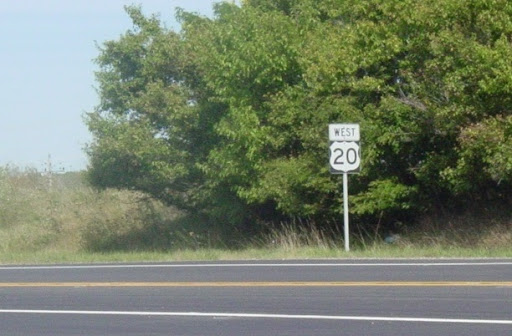
Some of those roads, particularly US Route 20, are different roads in different places. In this shot west of Starks IL, US Route 20 is a "rural" road:
Meanwhile, in Elgin, US Route 20 is a 4-lane bypass highway...
en.wikipedia.org/wiki/Elgin_Bypass
...as evidenced in this shot heading east in Elgin:
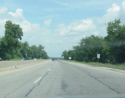
Beyond that line of trees on the right hand side is the Elgin Softball Complex where my bro-in-law's Tuesday team and my Dad's Friday team play.
Starting in 2008, I've researched new "routes"...or variations of paths I've taken before. The more I've driven the same roads, the more I actually NOTICE, including how...
...different things are spotted when traveling one direction on a road vs. the other direction on the same road [the crest of a hill in one direction might reveal a spectacular site (especially at sunset or sunrise), while the crest of that same hill going the other direction may only reveal a dilapidated old barn hidden among a grove of trees]
(and)
...routes interconnect/intersect with others, such as IL RT 47 crossing several major cross-country routes, including US Route 20, The Lincoln Highway, US Route 6 and famed US Route 66.
Thus, this year (2010), I started taking pics of the "road ahead" around here, similar to what I took along Route 66, except in some cases I added the element of "perspective". I took one pic in each direction, showing how the pathway looks different going one way versus traveling the other. Three examples....
#1 ... IL RT 47, intersection with BURLINGTON RD
NOTES
~15-20 minutes north of this intersection, IL RT 47 crosses US RT 20:
picasaweb.google.com/knightfan26917/RT66TRIPDAY15#5431275012661266562
~2+ hours south of this intersection, IL RT 47 crosses US RT 66:
picasaweb.google.com/knightfan26917/DriveSouthTNAL112709112909#5431282615925577026
Heading North on IL RT 47:
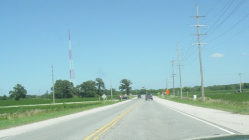
Heading South on IL RT 47:

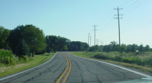
#2 ... RUSSELL RD, curve east of MUIRHEAD RD
Looking to the NorthEast:
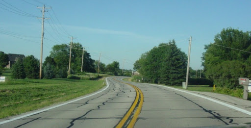
Looking to the SouthWest:
#3 ... NOLAN RD, between BOWES and HOPPS RDs
Looking South:
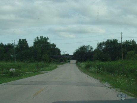
Looking North:
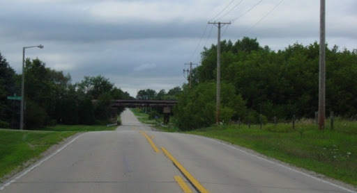
So...what have YOU noticed as you travel in your home area/state?
Cort | 36.m.IL | 5 Monte Carlos.1 Caprice Classic | pig valve.pacemaker * NoreastrTrekRT=Aug2010 *
MCs.CC | models.HO.legos.CHD.RadioShows | RoadTrips.us66 = www.chevyasylum.com/cort
"Life has been patiently waiting for me" ... Rascal Flatts ... 'I'm Moving On'
Around the Elgin area, I "exercise" my Monte Carlos on the same "old" roads west of Elgin, including US Route 20:
en.wikipedia.org/wiki/U.S._Route_20
en.wikipedia.org/wiki/U.S._Route_20_in_Illinois
Some of those roads, particularly US Route 20, are different roads in different places. In this shot west of Starks IL, US Route 20 is a "rural" road:

Meanwhile, in Elgin, US Route 20 is a 4-lane bypass highway...
en.wikipedia.org/wiki/Elgin_Bypass
...as evidenced in this shot heading east in Elgin:

Beyond that line of trees on the right hand side is the Elgin Softball Complex where my bro-in-law's Tuesday team and my Dad's Friday team play.
Starting in 2008, I've researched new "routes"...or variations of paths I've taken before. The more I've driven the same roads, the more I actually NOTICE, including how...
...different things are spotted when traveling one direction on a road vs. the other direction on the same road [the crest of a hill in one direction might reveal a spectacular site (especially at sunset or sunrise), while the crest of that same hill going the other direction may only reveal a dilapidated old barn hidden among a grove of trees]
(and)
...routes interconnect/intersect with others, such as IL RT 47 crossing several major cross-country routes, including US Route 20, The Lincoln Highway, US Route 6 and famed US Route 66.
Thus, this year (2010), I started taking pics of the "road ahead" around here, similar to what I took along Route 66, except in some cases I added the element of "perspective". I took one pic in each direction, showing how the pathway looks different going one way versus traveling the other. Three examples....
#1 ... IL RT 47, intersection with BURLINGTON RD
NOTES
~15-20 minutes north of this intersection, IL RT 47 crosses US RT 20:
picasaweb.google.com/knightfan26917/RT66TRIPDAY15#5431275012661266562
~2+ hours south of this intersection, IL RT 47 crosses US RT 66:
picasaweb.google.com/knightfan26917/DriveSouthTNAL112709112909#5431282615925577026
Heading North on IL RT 47:

Heading South on IL RT 47:

#2 ... RUSSELL RD, curve east of MUIRHEAD RD
Looking to the NorthEast:

Looking to the SouthWest:

#3 ... NOLAN RD, between BOWES and HOPPS RDs
Looking South:

Looking North:

So...what have YOU noticed as you travel in your home area/state?
Cort | 36.m.IL | 5 Monte Carlos.1 Caprice Classic | pig valve.pacemaker * NoreastrTrekRT=Aug2010 *
MCs.CC | models.HO.legos.CHD.RadioShows | RoadTrips.us66 = www.chevyasylum.com/cort
"Life has been patiently waiting for me" ... Rascal Flatts ... 'I'm Moving On'


